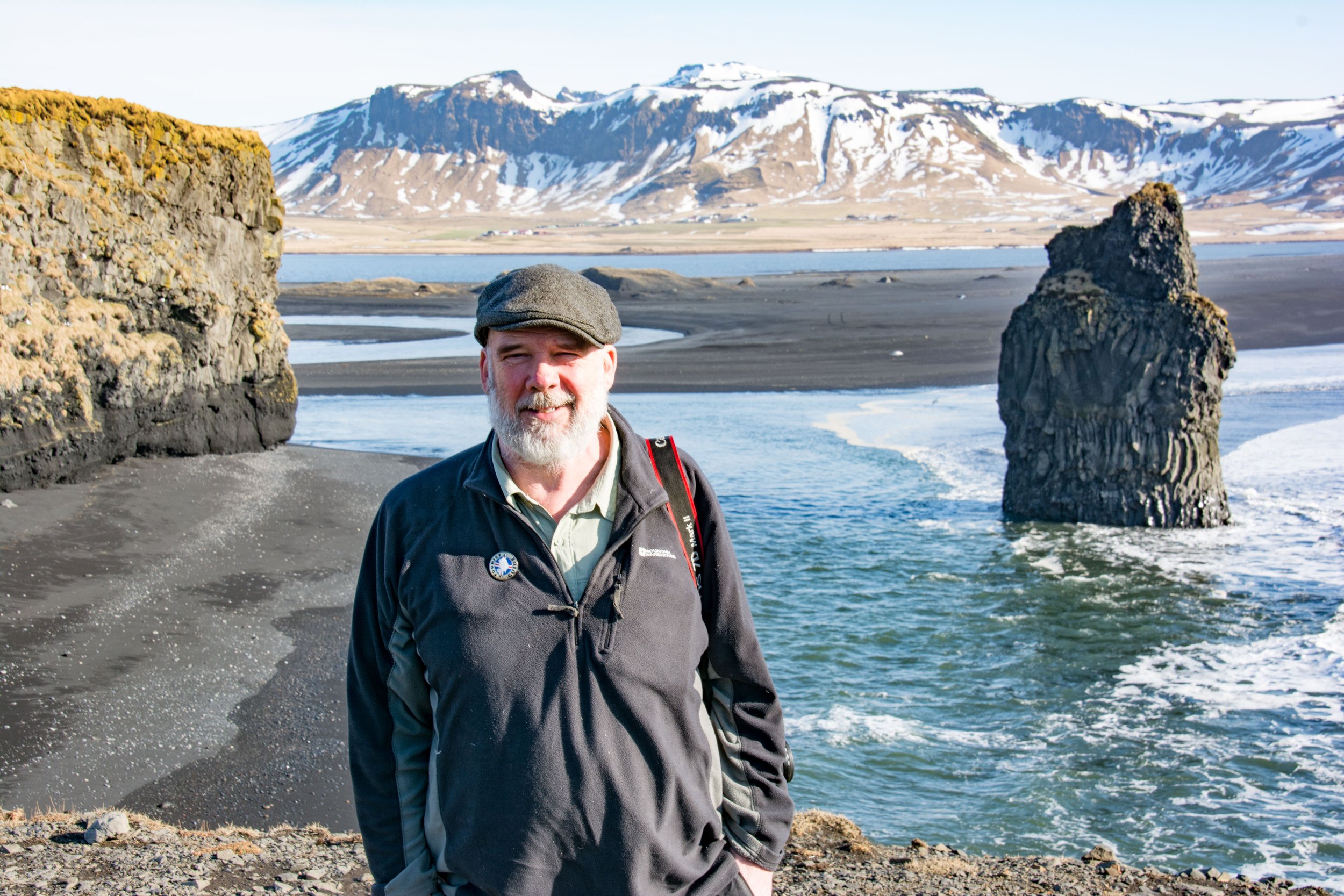
Guide to Visiting Vatnajökull National Park
Vatnajökull National Park in Iceland is the largest national park in Europe, a sprawling expanse of wilderness, glacial ice, and volcanoes. Encompassing the glacier of the same name, Vatnajökull, the protected area takes in all the surrounding landscapes that have been molded over millennia through the interaction between fire and ice.
The diverse landscapes on display here are staggering, ranging from snow-capped peaks to lush green valleys to tranquil highland lakes and barren volcanic desert.
The park's unique geology is a testament to Iceland's volcanic activity and glacial history. The glacier Vatnajökull itself is the most striking feature, a behemoth ice cap with numerous outlet glaciers extending like fingers into the surrounding lowlands. That ice is contrasted by areas of geothermal power, huge swathes of barren desert and glacial outwash, pockets of verdant forest, valleys, and lagoons, and some of Iceland’s most powerful and violent volcanic landscapes.
It's the natural attractions that are the stars of the show here; simply visiting the different areas and exploring is the easiest way to appreciate the volcanic powers that have shaped this region.
From the classic stops like Jökulsarlon Glacier Lagoon and Dettifoss Waterfall to the most remote and hard to access regions of the park in the Highlands, Vatnajökull National Park is a catch-all destination for those looking to understand and appreciate the grand scale of nature in Iceland.
Table of Contents
See more of our Iceland articles:


Why visit
There’s nowhere else in Iceland that gives you such a sense of the powers at play under the surface of this country as Vatnajokull National Park does. The sheer scale of this park immediately sets it apart, let alone the incredible natural attractions you can see within it. As such, it’s rightfully a haven for outdoor enthusiasts and those seeking a bit of adventure.
By far and away the best way to experience the park is on two feet. You’ll quickly leave the crowds behind and will get up close and personal to a pristine wilderness.
Whether it’s exploring the trails in one of the easier-to-access locations of the park or an extended multi-day trek through barren, volcanic desert to the fringes of the glacier in the remote Highlands, any and all hikers who visit Iceland should absolutely make a beeline for this famous national park.
Where is Vatnajokull?
Vatnajökull National Park spans several regions of Iceland, including the southeast, the east, the north, and several areas of the Highlands. Its territories cover the glacier Vatnajökull, the largest ice cap in Europe, and the fascinating landscapes on all sides that have been created through an age of volcanic eruptions and glacial floods.
Depending on which parts of the national park you’re interested in, you’ll need to access them from different locations around the country.
From Reykjavik, the fastest way to get to the national park is to shoot along the ring road through the south coast. Kirkjubæjarklaustur is a small village between Vik and the glacier and acts as an entry point into the remote southwest corner of the park located in the Highlands.
Further to the east of here is Skaftafell, a bowl-shaped area located between glacier tongues coming down from Vatnajökull. This is the easiest entry point, as from the visitor’s center there are fantastic hiking paths. Follow the ring road further into the southeast corner and you’ll also find the Jökulsárlón Glacier Lagoon and Diamond Beach, two of the park’s most famous attractions.
From here, things get more remote. The huge swathe of eastern Highlands that makes up Vatnajökull National Park is mostly wilderness, only accessible in summer via 4x4. The same can be said of the area north of the glacier, sub-Arctic desert and some violent volcanic landscapes.
Further north still, and not sharing any borders with the rest of the national park, is the Jökulsárgljúfur area, containing the waterfall Dettifoss and Ásbyrgi Canyon.
Best time to visit
Due to the sheer size of the national park, I’m going to split up my recommendations – one for the lowland areas, and one for the Highland areas.
When to visit the lowland areas of the park
If you’re planning on visiting Skaftafell, Jökulsárlón, and Heinaberg for sightseeing, the best time to visit is late May and early June. These locations are all in the southeast corner, where the glacier edges close to Iceland’s coast.
This brief window of spring before turning to summer brings with it huge amounts of daylight, awesome golden hour sunsets, and shoulder season prices and crowds. Note that if you’re set on doing a kayaking tour in either Jökulsárlón or Heinabergslón, they only begin in the second half of June.
For Jökulsárgljúfur Canyon in the north of Iceland, the best time to visit is in late June. The higher latitude means that there is often still snow on the road to Dettifoss even in June, and it is often closed due to the remote area of the road.
Summer: In these lowland areas is, like most other places in Iceland, the busiest time to visit. There are crowds at Skaftafell and Jökulsárlón (although most are yet to discover the Heinaberg area), and hotel costs are high. Still, the weather is at its mildest, and in Skaftafell, you can also escape the crowds by venturing further into the area on the hiking trails – not just to Svartifoss and back.
Autumn: Autumn is a beautiful season to visit too, with the changing colors in Skaftafell plus the moody skies over the glacier. However, there’s a big increase in rainfall in late September and October. There’s a chance to see the northern lights, lower prices, and come October, tours into the ice caves begin, which might be reason enough to brave the rainy season.
Winter: Winter provides a different kind of experience in the lowlands of Vatnajökull National Park. The snowy landscapes are beautiful, but you’ll have limited access in Skaftafell, with trails closed due to icy conditions. Jökulsárlón Glacier Lagoon is also more still, with the icebergs jammed together rather than freely flowing out to sea. It’s likely that Jökulsárgljúfur is completely shut off due to snow.
When to visit the highlands of the park
The best time to visit the Highland regions of Vatnajökull National Park is in late June and early July. The median date for most F-road openings falls sometime in mid-to-late June, meaning if you plan your trip to begin at the end of June, you’ll get a low chance of rainfall, open roads, and no crowds.
July is also a good time to visit, with even calmer weather and all roads open. Still, crowds increase at all locations, and it can be hard to find yourself alone in nature. Prices are also high, and accommodation for July often books out a few months in advance.
August is when most of Europe is on holiday, and Iceland is packed – even the remote areas of the Highlands. As it moves towards the end of the month, temperatures begin to drop, and the evenings quickly draw in closer, skies threatening more rain.
September is a continuation of August but with far fewer people as everybody returns to work. Chances of rainfall are higher as the month moves on, which might make rivers impassable. But of course, there’s always a chance that this month is mild, sunny, and calm.
Connect with a local expert in Iceland for help perfecting your itinerary, answers to all your travel questions, and fabulous local tips for a better visit!
How long to spend in the park
The average visitor to Iceland usually spenda two to three days dipping in and out of the national park, mostly sticking to the main accessible areas. This allows for exploring in Skaftafell and a glacier hike on Vatnajökull, admiring the glacier lagoon and other glacier tongues in the southeast, and then driving the length of the Jökulsárgljúfur Canyon in the north (although that’s another couple of days’ drive away from the southeast corner).
If you have limited time in Iceland and just want to stick to this 2-3 day plan, here’s what I’d suggest:
3-day highlights itinerary
Day 1: Spend your first day visiting the Skaftafell area of the national park. Here, you can hike to the stunning Svartifoss waterfall and the continue deeper into the region, turning up views of the glacier and glacier tongues creeping down through the mountains.
Day 2: Start with a glacier hike, which will take most of the morning. Then, hike more at Múlagljúfur Canyon, before heading along the southeast ring road where you’ll find the famous glacier lagoon and Diamond Beach. Spend the night in Höfn.
Day 3: After travelling up to the northern region of Iceland (about one day from Höfn), spend a third day exploring the national park at Jökulsárgljúfur. This canyon is home to Dettifoss and Ásbyrgi Canyon, two big hitting attractions.
More extensive 6-day itinerary
The short hit-and-run itinerary above only takes in the most accessible parts of the national park, so for a more complete introduction and to reach the further flung areas, like the Highland Regions, you’ll need several more days.
Day 1- Southwest Highlands: From Kirkjubæjarklaustur, a full day can be spent traveling to and exploring either Lakagígar or Eldgjá and Langisjór, huge volcanic landscapes covered with green moss and contrasted by views of the southwest glacier tongues branching off Vatnajökull.
Days 2 & 3 – Skaftafell and Jökulsárlón: Follow the same two-day itinerary from above.
Day 4 – Snæfell: From Höfn, drive all the way into the Eastern Highlands, staying overnight at the Snaefell Mountain Hut and making the most of your afternoon and evening by either scaling the mountain or exploring the wild area.
Day 5 – Askja: From Snæfell, you’ll drive north along the F-roads, stopping off to fill up with petrol at Möðrudalur, the most elevated working farm in the Highlands. Then, turn southwest and drive to Askja, where you can explore the volcanic caldera and stay overnight at the Dreki Mountain Hut.
Day 6 – Jökulsárgljúfur: From Dreki, drive north and spend the day in the Jökulsárgljúfur area.
Where to stay - best bases
Vatnajökull National Park is expansive, with a variety of accommodation options both within and around the park. There are also a handful of mountain huts and campsites in the more remote regions. Here are some of the areas and specific accommodations that I’d recommend considering:
Kirkjubæjarklaustur
This small town in South Iceland is directly on the ring road and is right next to the F-roads that lead up into the southwest corner of the national park.
The southeast
From Skaftafell all the way to Höfn, there’s a great number of hotels, private apartments, guesthouses, and a handful of campsites to choose from. This is the best area to stay for easy access to Skaftafell, Jökulsárlón Glacier Lagoon, and tours up onto the glacier.
Snæfell Mountain Hut
The eastern territory of Vatnajökull National Park is far more remote than the southeast. The closest town is Egilsstaðir, the largest in the region, but it’s a fair distance from there into the national park. A better option is to book a bed at the Snæfell Mountain Hut inside the park’s boundaries. A 4x4 is required to get there.
Möðrudalur Farm or Dreki Mountain Hut
The area north of Vatnajökull glacier is also very remote, only accessible with a 4x4. There’s limited accommodation as well. The Dreki Mountain Hut is a short drive away from the Askja Caldera, and a good option for an extended stay in the area. A bit further away is Möðrudalur, the most elevated farm in Iceland that doubles as a guesthouse.
Jökulsárgljúfur Region
The northernmost section of Vatnajökull National Park is easily accessible. The southern end of this territory is a short drive away from Lake Mývatn, where there is plenty of accommodation to choose from. The northern end has the campsite in Ásbyrgi Canyon and is also a short drive away from the town of Húsavík.
Logistics of visiting
Opening hours & seasonal accessibility
Vatnajökull National Park is open year-round, and 24 hours a day. What you need to consider though is that there are certain areas that have seasonal accessibility. This is Iceland after all, and weather conditions are poor in winter.
This does mean that some areas can be ‘closed’ because of impassable roads or poor weather. The parts of Vatnajökull National Park in the Highlands are only accessible when the mountain roads are clear of snow after the spring – different roads open at different dates throughout June and July.
Park Entrance points & visitor centers
The park now has a handful of visitor centers spread across the region, each covering specific areas of the park.
The Skaftárstofa Visitor Center - Kirkjubæjarklaustur
Eldgjá & Langisjór
Lakagígar
The Skaftafellsstofa Visitor Center - Skaftafell
Skaftafell
Jökulsárlón
Heinaberg
The Snæfellsstofa Visitor Center - Route 933, East Iceland
Snæfell
Krepputunga
Gígur Visitor Center - Lake Mývatn
Askja & Herðubreiðarlindir
The Hrauneyjar Visitor Center - Route 32, Southern Highlands
Nýidalur and Tungnaáröræfi
Gljúfrastofa Visitor Center - Ásbyrgi Canyon
Jökulsárgljúfur
Entry & parking fees
Entry to the park is generally free, but there are certain locations where you must pay for parking. For instance, at Skaftafell and the Glacier Lagoon, there are parking fees. Elsewhere parking is free.
Other than that, you will also need to pay for a tour if you’re planning on doing any activities on Vatnajökull Glacier. Guided hikes, ice cave tours, ice climbing, and snowmobiling all require a licensed guide.
Accessing the Highlands of the park
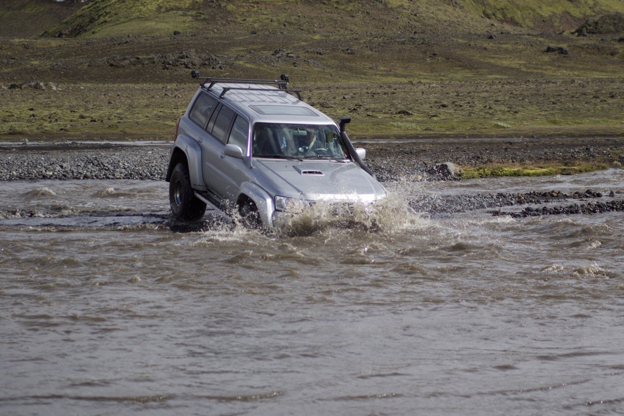
I’ve already mentioned it in passing, but to drive into the Highland regions of the national park, you will require a 4x4 vehicle. Anything else is illegal, and highly risky; you often need to ford glacial rivers to get to your destination, and I’ve seen more than a few regular vehicles that have been drowned in the river.
There are no services in the Highlands, so you need to fill up with petrol before tackling the F-roads, and make sure you have enough food and water.
Do you need a guide?
In general, you don’t need a guide to explore the national park. For any tours on the glacier, it’s required, but other than that, you’re free to roam along the trails.
Some of the national park rangers offer guided hikes starting from the remote mountain huts in the highlands.
Restaurants & facilities
There are only a handful of restaurants and shops near to the national park, most of them centered around the Skaftafell area and southeast stretch towards Höfn. The visitor centers listed above are where you can pick up detailed maps of the park and all hiking trails, use free public restrooms, and some small souvenirs.
In the highlands, public restrooms can often be found at trailheads and the mountain huts.
Areas of the park to visit
Eldgjá & Langisjór – Southern Highlands
In the southwest corner of the park, the major areas to visit are Eldgjá, the largest volcanic canyon in the world, and Langisjór, a huge lake. Eldgjá cracked open during a huge eruption in 939 and is 270 meters at its deepest point and stretches for 40km. Hiking through the striking canyon takes you to the cascading Ófærufoss waterfall, or you can choose to hike up a challenging mountain.
In contrast, Langisjór is much more serene. This is one of Iceland’s clearest lakes, and the peaceful shores of the water contrast with the moon-like black desert that surrounds it, ringed by moss-green mountains. There are hiking trails that meander along the shores of the lake, up into the hills for views of the lake, or even further to scale up nearby mountains.
Lakagígar – Southern Highlands
Lakagígar, or the Laki craters, are a row of craters formed during a massive volcanic eruption in 1783-1784. This catastrophic event reshaped the landscape, creating a series of craters and lava fields.
Like Eldgjá and Langisjór, this is a little-visited part of the national park and is an ideal spot for some longer hikes to appreciate Iceland’s stunning beauty and the volcanic powers at play.
Skaftafell – Southeast Iceland
Skaftafell is a paradise for hikers and nature lovers, offering a mix of lush landscapes, glacial views, and waterfalls. It’s one of the easiest access points into the national park, directly on the ring road.
That does mean it gets crowded in summer, but mostly visitors will do a hit-and-run visit to Svartifoss waterfall, with its distinctive basalt columns. Venture further into the park and you’ll quickly leave the crowds behind.
Jökulsárlón – Southeast Iceland
Jökulsárlón is the famous glacial lagoon renowned for its striking icebergs floating in turquoise waters. It's a mesmerizing spot no matter the season, but especially pretty at golden hour. Across the road, Diamond Beach is where the icebergs wash up again after being pulled out to sea and caught by the strong ocean tides which deposit them on the black sand.
Also in the area is Fjallsárlón, a smaller glacier lagoon that is also a nice place to explore.
Heinaberg – Southeast Iceland
Heinaberg is the name given to the stretch of glacier tongues and valleys in the southeast between Jökulsárlón and the town of Höfn. The area is accessed via rough gravel roads, and remains an overlooked area of the park, offering close encounters with the glacial tongues as they creep down from the ice cap Vatnajökull.
There are adventurous and little-traveled hiking trails, and a remote glacier lagoon Heinabergslón that’s home to a kayaking tour where you’ll land on the icebergs and hike across.
Snæfell – Eastern Highlands
Snæfell, Iceland's highest freestanding mountain, offers sweeping views over Vatnajökull and the surrounding highlands in the eastern region. This is untamed countryside and features a surprising amount of vegetation that draws in a diverse amount of wildlife, including Iceland’s wild reindeer.
Hiking here mainly involves scaling Snæfell itself or wandering through the rolling hills past glacial rivers and into valleys.
Krepputunga – Northeastern Highlands
Krepputunga is in the highlands north of the glacier Vatnajökull, situated between two glacial rivers. It’s a desolate place, characterized by volcanic formations, black sand deserts, and pockets of verdant flora where spring water emerges from beneath lava fields.
The Sigurðarskáli cabin in Kverkfjöll at the northern edge of Vatnajökull glacier provides a good base for some of the country’s more adventurous hiking trails.
Askja & Herðubreiðarlindir – Northern Highlands
Askja and Herðubreiðarlindir are a bit further west of Krepputunga, another area of desolate sub-Arctic desert and volcanic activity. Approaching the region from the north, you’ll first pass the striking Herðubreið mountain, often dubbed the "Queen of Icelandic Mountains”. Hikes toward the base of this mountain deliver you into an area of pristine springs and thriving plant life, a tranquil oasis amidst the otherwise stark volcanic terrain.
Further south, Askja is a different beast altogether. This huge volcanic caldera was formed by an eruption in 1875, it’s a place to admire the giant Lake Öskjuvatn, the deepest lake in Iceland, and the crater right next to it called Viti, filled with a warm, chalky-blue water that’s fit for swimming.
Nýidalur & Tungnaáröræfi – Central Highlands
Nýidalur and Tungnaáröræfi are remote highland areas known for their rugged beauty and isolation, accessed via the F26 highland road, otherwise known as the Sprengisandur Route. Nýidalur is a lush valley, a sort of oasis in the otherwise barren swathe of highland.
In contrast, Tungnaáröræfi is made up of vast lava fields, black sand desert, and silvery glacial rivers interlocking across it all. A mountain hut at Nýidalur offers bunk space for extended explorations.
Jökulsárgljúfur – North Iceland
Jökulsárgljúfur canyon, disconnected from the rest of the national park, is a giant canyon that carves through the northeast of Iceland. It belongs to the national park because it was the eruptions and subsequent glacial floods that created this canyon, huge bursts of power sent from the glacier flowing down the river.
Its most famous attraction is Dettifoss waterfall, the most powerful waterfall in Europe, a giant roar of water and mist flanked by the basalt canyon.
Elsewhere, fascinating rock formations and the giant horseshoe-shaped canyon, Ásbyrgi.
What to see and do in the park
1. Vatnajökull glacier
The obvious star attraction of Vatnajökull National Park is its namesake glacier, Vatnajökull. It’s the biggest glacier in Europe, and after years of traveling all over Iceland, I can safely say that I’m not yet sick of looking at it and exploring both its fringes and on top whenever I can.
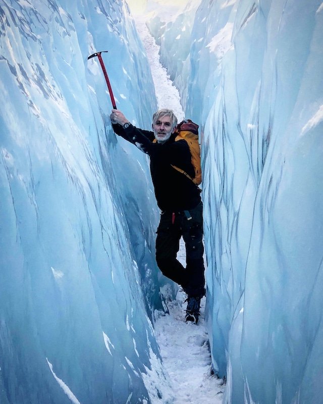
If you’re keen to experience the ice, glacier hikes are the best, and in winter, the ice caves are pretty special. Whichever of these experiences you choose to partake in, you’re sure to remember them vividly. There’s something special about glaciers.
2. The Vatnajökull ice caves
I’ve already mentioned the ice caves under Vatnajökull, but these are so special it bears repeating. Visit between October and April and you’ll be able to join one of these tours, where you’ll adventure into the ice caves that change every season.
There’s truly nothing like it: the electric blue colors cut with black ash trapped in the ice from previous eruptions, the silence of the caves save for the slow dripping of water, and the abstract patterns of air trapped in the ice.
3. Hiking in Skaftafell
My top area in the country for hiking. I love the waterfall Svartifoss, the most popular attraction in the area, but there are also plenty of longer hiking trails as well that venture deeper into the area. Mountains, glacial valleys, and even one of Iceland’s rare forests are all accessible here.
Look to Morsárdalur and the distant glacial valley of Kjos for the most remote hikes, but make sure to talk to the rangers working at the visitor’s center before undertaking either.
4. Dettifoss waterfall & Ásbyrgi canyon
Dettifoss Waterfall is one of the country’s most famous sights, and lives up to the hype, a huge thunderclap of dirty grey glacial water and mist churning together in a valley of basalt.
Further north, Ásbyrgi Canyon is a remarkable place and blessedly far from the ring road, a giant horse-shoe shaped canyon that was carved out by a glacial flood in a matter of days. It’s also home to a tranquil forest and pond at its base.
Photo: Michal Klajban, CC BY-SA 4.0, via Wikimedia Commons
5. Jökulsárlón glacier lagoon
A classic experience to do at the Jökulsárlón Glacier Lagoon. There are two types of boats: Amphibian boats that drive overland before heading out on the water, and zodiac boats, which are inflatable boats that are much faster, covering more of the lagoon on a tour.
For a calmer experience, kayaking is the way to go, although it’s only available from mid-June until mid-October.
6. Diamond Beach
Another classic sight on the ring road is Diamond Beach. Once the icebergs in Jökulsárlón are swept out through the channel to sea, they’re quickly washed up back on this shore of black sand.
Here, they’re slowly shaped by the light and wind into zany shapes, turning the beach into a natural outdoor sculpture gallery.
7. Tackle the F-Roads
There’s something so exhilarating about driving on the F-roads, Iceland’s unpaved mountain roads that weave through its most rugged areas. Maybe it’s the fact that you need a 4x4, which gives them a certain edge, perhaps it’s the periodic streams and rivers that you may need to forge across, or it could just be the truly unbelievable scenery they’ll take you through.
There’s no question that these are some challenging roads to drive, but the reward you get for braving them is absolutely worth it.
8. Askja volcanic caldera
I’ve already covered the Askja region above, but it’s worth reiterating that this is an absolute highlight of Vatnajökull National Park. Such volcanic beauty amid a stark and desolate landscape is intimidating and powerful to see.
Photo: Wolfgangbeyer, CC BY-SA 3.0, via Wikimedia Commons
9. Visit the hot spring waterfall, Laugarvellir
The Eastern Highland surely don’t get enough love as they should. If you’re adventuring in the area, maybe hiking around the Snaefell area, don’t miss taking a dip in Iceland’s most unique geothermal pool, fed by a hot waterfall.
10. Hike to the base of Herðubreið, Iceland’s queen of mountains
Herðubreið Mountain, which I’ve already mentioned in the sections above, is Iceland’s Queen of Mountains. It’s a beautiful sight, and hiking towards the base puts you in a beautiful highland region of springs.
11. Take a mountaineering & glacial skills course
Iceland is a country filled with glacier guides, mountaineering experts, and just general outdoorsy people. It makes sense that it’s a great place to up your skills, and Vatnajökull National Park and the glacier tongues of the southeast are the epicenter of all schools – check out the Icelandic Mountain Guides for more.

Connect with an Iceland local expert for help perfecting your itinerary, answers to all your travel questions, and fabulous local tips for a better visit!
Best trails and hikes
Considering that the park covers such a huge amount of terrain and encompasses several different regions of Iceland, there is an almost countless number of hikes that you could do here, with no shortage of spectacular ones.
With that in mind, the list below is by no means definitive or all-inclusive, but it covers some of my favorite hikes in the park’s boundaries.
1. Svartifoss Waterfall & Sjónarnípa Viewpoint
Skaftafell | 5 miles (8 kilometers) return | 3 hours
The classic trail that everyone does in Skaftafell, with the addition of heading to the Sjónarnípa Viewpoint as well. Svartifoss is a beautiful waterfall that tumbles over black cliffs of hexagonal basalt. From here, a trail ventures further up onto the heath towards the northeast, where the Sjónarnípa viewpoint at the edge of the cliffs provides a birds-eye view over the glacier tongue Skaftafellsjokull. From here, another trail takes you down the cliff and back toward the visitor’s center.
2. Múlagljúfur Canyon
Jökulsárlón Area | 4 miles (6.4 kilometers) round-trip | 2–3 hours
A stunning hike that is growing in popularity, this beautiful canyon cuts into the mountains on the southeast side of the glacier, southwest of the glacier lagoon. It takes about an hour to hike to the best viewpoint, where you’ll look deeper into the canyon, where waterfalls rush down the walls, and the vibrant greens contrast with steely grey rocks and the dark, cone-shaped mountain at the very end.
3. Mount Laki
Lakagígar | 2.5 miles (4 kilometers) round-trip | 1–1.5 hours
The best way to appreciate the sheer scale of the Lakagígar crater row is to hike to the top of Mount Laki. Beginning in the parking area, it’s a steep climb, but the rewards are just the best views. It goes without saying that if it’s foggy, maybe think twice before heading up the mountain.
4. Fláajökull Trail
Heinaberg | 2.8 miles (4.5 kilometers) round-trip | 3–4 hours
A little-visited area of the national park, the Fláajökull Trail in the southeast of the country leads to one of the more remote glacier tongues in the region. It takes a couple hours, but there’s hardly anyone else in the area, and the jagged ice of the glacier tongue at the very end is easy to walk right on up to.
The area also features huge black sand dunes and an expansive but empty lagoon, both left behind as the glacier has retreated.
5. Drekagil Gorge
Askja | 10 miles (16 kilometers) round-trip | 6–8 hours
An adventurous way to get to Askja, with the volcanic caldera slowly revealing itself as you clamber along the edge of the Drekagil Canyon. This stretches from the Dreki Mountain Hut all the way to the caldera itself, roughly 5km away.
Most people will simply drive to the Askja parking area, but this is a great way to spend some time in the remote region since there aren’t many hiking trails at Askja itself.
6. Sveinstindur Mountain Hike
Langisjór | 2.5 miles (4 kilometers) round-trip | 2–3 hours
If you’re in the Langisjór area, scaling the Sveinstindur Mountain will give you unbeatable views over this stunning and remote landscape. It’s a moderately steep trail but will only take just over an hour to reach the top.
7. Jökulsárgljúfur Canyon Hike
Jökulsárgljúfur | 20 miles (30 kilometers) one way | 2 days
This is one of my favorite hikes in Iceland, and it travels all the way from Dettifoss to Ásbyrgi, tracing almost the entire length of the Jökulsárgljúfur Canyon in the north.
I’d suggest splitting the hike into two easy-going days with an overnight at Vesturdalur Campsite (tents only), after which you can catch the public bus from Ásbyrgi back to Dettifoss to collect your car (if you have one).
8. Ásbyrgi Eastern Rim Trail
Ásbyrgi Canyon | 5.6 miles (9 kilometers) round-trip | 3–4 hours
Ásbyrgi itself also is a great place for some hikes. The canyon rim trail begins at the visitor’s center and leads you up around the eastern edge of the canyon, leading to base of the canyon where you’ll stand about 100 meters above the forest and pond at the canyon floor below.
From here, you’ll backtrack a bit, cutting down to the canyon floor via a stair and rope ladder.



Connect with an Iceland expert!


