Icelandic Highlands Travel Guide

The Icelandic Highlands, an expansive and remote plateau, form the heart of Iceland's wild, untamed beauty. Characterized by stark landscapes, rugged mountains, sprawling glaciers, and volcanic activity, this remote region is a haven for adventure seekers and those looking to immerse themselves in Iceland’s wildest landscapes.
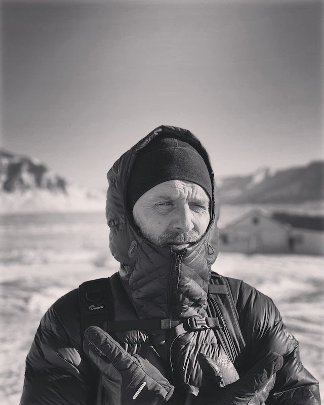
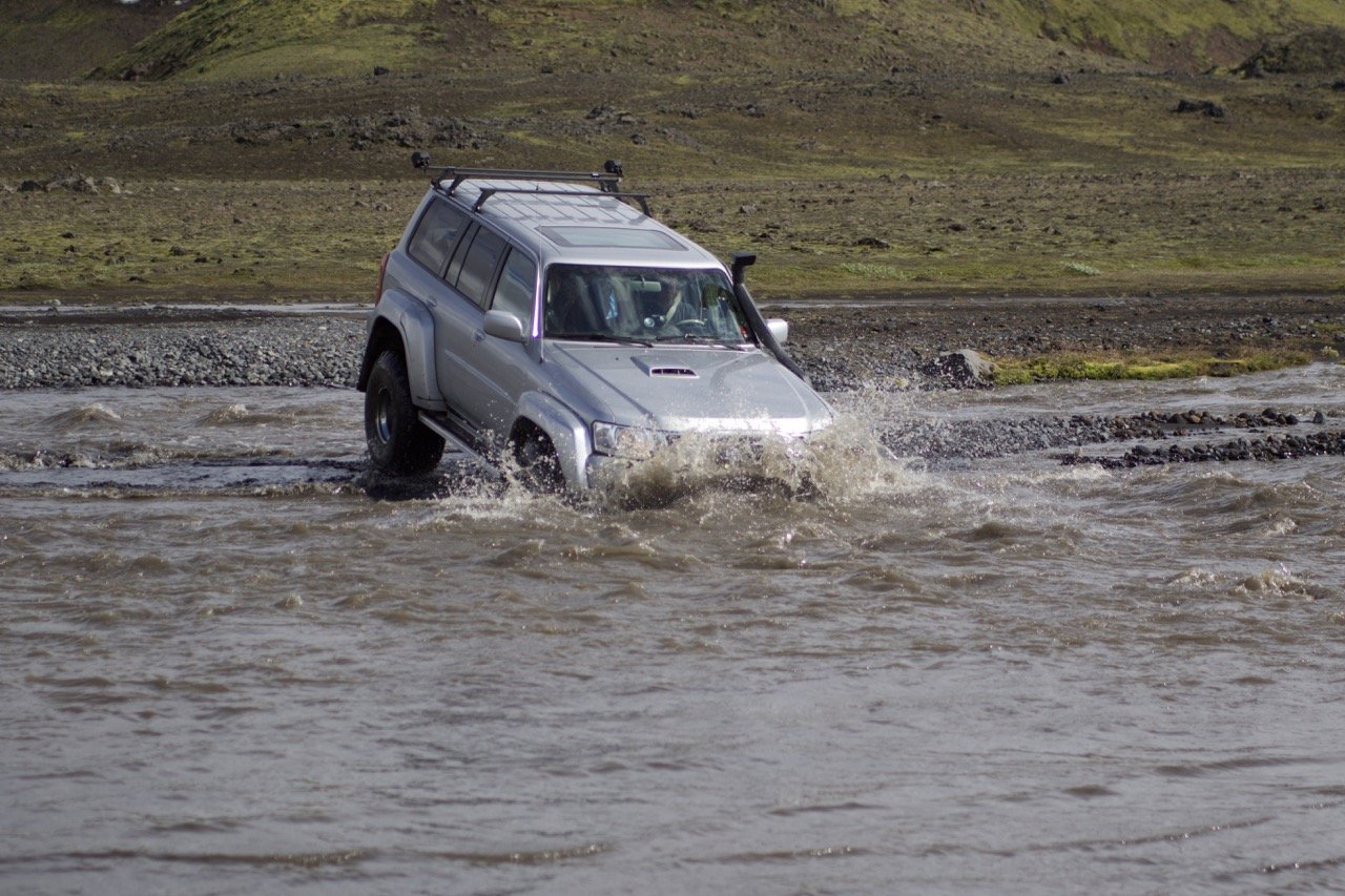
Those who journey here can expect a healthy challenge. You’ll need a 4x4 vehicle and the grit to ford rivers, but the rewards are great. This is the region where the raw power of Iceland’s nature is most evident, offering vast lava fields, huge areas of geothermal power, and powerful glacial rivers carving their way through canyons and desert.
But the best reward is the opportunity to disconnect with the modern world completely and immerse yourself in a completely unique wilderness. Uninhabited and only accessible for around three to four months in the summer, this region is a must-visit for those looking to experience the untouched and dramatic beauty that Iceland is renowned for.
Table of Contents
See more of our Iceland articles:


What are the Icelandic Highlands?

Highland areas show in brown. Photo: Map_of_Iceland_highlands.svg by Pethrus based on Map_of_Iceland_el.svg by Αντιγόνη derivative work: Pethrus, CC BY-SA 3.0, via Wikimedia Commons
The Icelandic Highlands, or Hálendið in Icelandic, encompass the central plateau of the island. This natural area is defined by its high altitude and volcanic origin, consisting of vast lava fields, glaciers, and mountains.
Unlike other regions, the Highlands do not have permanent settlements due to the harsh and inhospitable conditions, but there are roads that traverse the region.
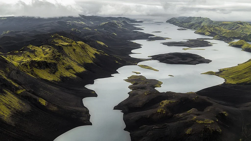
Geographically, the Highlands cover a significant portion of Iceland, sitting between the more populated coastal regions. The area includes famous landmarks such as Vatnajökull, Europe’s largest glacier, Landmannalaugar and its colorful rhyolite mountains, and the secretive Thórsmörk.
The Highland plateau is also, in places, Iceland’s former coastline before volcanic activity created new coastline on the lowlands, where the ring road travels today.
Why visit
The Icelandic Highlands are distinct from any other place in Iceland due to their raw and unfiltered natural beauty. Visitors are drawn to the region for its sense of isolation, dramatic landscapes, and the adventure that comes with exploring such a remote area.
This region is far removed from the bustling tourist spots along the coast and offers an unparalleled experience of Iceland’s rugged and pristine wilderness. If you’re looking to connect deeply with nature and find yourself alone in a vast and untouched wilderness, the Highlands are for you.
Hiking in the Highlands is a must for any outdoor enthusiast. The region is a hiker's paradise, with trails traversing some of Iceland’s most spectacular landscapes. The Laugavegur Trail is the most famous, a four-to-five-day trek stretching from Landmannalaugar to Thórsmörk and winding through colorful rhyolite mountains, black sand deserts, and lush green valleys.
But that’s just the beginning – any other of the destinations in the Highlands involve epic hikes, rewarding those who made the effort to reach this remote area with some unbeatable panoramas.
For travelers seeking a challenging adventure, the Highlands are one of the best places to come. This is a vast wilderness with limited services, so any travel in the region means you must come prepared.
The F-roads that traverse the region are only for 4x4 vehicles, rough tracks that vary in quality and often mean you’ll have to ford a glacial river. Once you’ve reached your destination, there’s often nothing more there than some information about the hiking trails ahead – other than that, you’re on your own.
Volcanic landscapes are another fascinating aspect of the Icelandic Highlands. Whereas you can see craters and lava fields around the ring road, there’s really nothing like what you can see in the Highlands. This is where most of Iceland’s volcanic activity originates, and the landscapes show off the sheer primordial power at play as the country continues to be molded and shaped by eruptions.
Finally, for any photography enthusiasts looking to capture some unique shots of untouched Icelandic nature, the Highlands is the destination for you. The dramatic scenery and vast open spaces make it easy to take home some great photos, from the vibrant mountains of Landmannalaugar and Kerlingarfjöll to the explosive craters of Lakigigar and Askja.
With a drone, you’ll also be in for a real treat, capturing glacial rivers braiding their way across black sand desert, bright green mountains emerging from twisted black lava fields, and deep valleys of moss and basalt.
Where are the Highlands and how to get there

Photo: Emstrur, CC BY-SA 4.0, via Wikimedia Commons
The Icelandic Highlands make up the central part of Iceland, essentially bordered by the Ring Road (Route 1) which circles the island. Key entry points to the Highlands are often accessed via towns on the periphery, such as Akureyri in the north, Egilsstaðir in the east, and Selfoss in the south.
The further you venture inland, the higher altitude you’ll reach, and the rougher the roads become.
Getting here
Reaching the Icelandic Highlands from Reykjavik requires careful planning and a sense of adventure. Due to the rough and often unpredictable terrain and the fact that most roads will require you to ford a glacial river, you must have a 4x4 vehicle to access this remote region.
Standard cars are not only unsuitable for the F-roads, but illegal as well. These F-roads are only open during the summer months, typically from June to September, when the snow and ice have melted enough to allow safe passage.
There are also a few bus routes that you can make use of. Public transport services the most popular regions in the Highlands, including Landmannalaugar, Thorsmork, and Kerlingarfjöll. For any other destinations in the Icelandic Highlands, organized tours are available, although they obviously involve long days of driving.
The distance from Reykjavik to major Highland entry points varies, but it typically takes between 4 to 6 hours by car, depending on the specific destination and road conditions. For instance, reaching the start of the Kjölur route (F35) at Gullfoss is about 78 miles (125 kilometers) and takes around 2 hours.
Continuing through the Highlands to Kerlingarfjöll can take another 3 hours from here. Similarly, accessing the Sprengisandur route involves a drive of about 112 miles (180 kilometers) to the southern starting point near Hekla, taking approximately 3 hours, with the entire route requiring a full day’s journey to complete.
Connect with a local expert in Iceland for help perfecting your itinerary, answers to all your travel questions, and fabulous local tips for a better visit!
Best time to visit

The Highlands are a special region within the country, with the roads only opening for the summer season. Generally, most will be open by mid-June, although this is dependent on warmer temperatures and the snow melting away.
The Icelandic Road and Coastal Administration oversee the road conditions, monitoring them and declaring them open for business once the tracks have dried enough after the melting snow. Once the F-roads are open, they stay open until around the end of September.
Visiting in Summer
A September visit
The best time to visit the Highlands in Iceland is at the beginning of September. Timing your trip for the tail end of the summer means that you’ll narrowly avoid the crowds that are there in August, which is the most popular time to visit. It’s also very unlikely at the beginning of September that the F-roads will be closed; most remain open until the end of the month.
With fewer crowds, it will be much easier to find yourself alone in the vast landscapes as you explore the different Highland destinations and enjoy the remote hiking trails. What accommodation there is in the Highlands is also cheaper.
The later you leave your trip in September, the colder it becomes, and by the end of the month there’s a much higher chance that it will begin to snow, making roads and hiking trails impassable.
Visiting in June
June is the very first month you can visit the Highlands, and it’s also a good choice for a trip. It’s during this month that the F-roads will be checked and declared open, however, that can also pose a problem. Last-minute storms can easily delay road openings, disrupting any potential plans you have.
A rainy spring will also delay openings, since the roads are a mess of mud and snowmelt and driving on them at this time causes a lot of damage.
For these reasons, planning a trip through the Icelandic Highlands after mid-June lowers the chance your plans will be disrupted due to a delay in the roads opening.
Visiting in July & August
July and August in the Highlands is when the weather is at its calmest, and this is the most popular time to visit the Highlands. Temperatures are mild, roads and hiking trails are accessible, and the daylight hours are long, allowing for extended exploration.
However, since this short window of accessibility coincides with most people taking vacation time, it also means that during these months the Highlands can get surprisingly crowded. Landmannalaugar is one of the busiest spots – more people venture up here in the summer than to the entire region of the Westfjords all year.
What to know if you come outside of Summer
Even when the F-roads have been declared closed, there are still options to visit some destinations in the Highlands. Buses travel to Thórsmörk and the Kerlingarfjöll Highland Base year-round, offering good hiking opportunities in autumn and spring and the chance for snow-based activities in winter.
Other destinations in the Highlands can also be reached, although only with private tours.
Visiting in Fall
As the summer fades, the Icelandic Highlands transform into a mosaic of golden and red hues. Things quickly become much colder, and snow can arrive as early as mid-September. Days are getting much shorter, and there’s also an increased chance of stormy weather and strong winds.
But, with the dark nights comes chances to spot the northern lights as well. During this time, we recommend visiting Thórsmörk, where you can see the autumn colors in the large birch forests throughout the valley.
Visiting in Winter
The highlands become a pristine winter wonderland, with vast expanses of snow-covered mountains and frozen rivers. Only specialized vehicles operated by experienced guides and locals dare venture into the remote and silent wilderness during the cold, dark season.
Travelers should expect extreme cold, limited daylight, and blizzards. During winter, we recommend visiting Kerlingarfjöll, offering a luxurious base for skiing and snowmobiling in the nearby geothermal mountains.
Visiting in Spring
As the snow begins to melt after winter, the highlands undergo a dramatic transformation. Rivers swell with glacial meltwater, and the landscape starts to awaken from its winter slumber. However, the melting snow and increased water flow make most roads and rivers impassable during this time, restricting access to the region.
How long to spend
To get a good feel for the variety of the Icelandic Highlands and visit several destinations, you’ll need at least five or six days. The rough roads mean that traveling time here is a lot longer than the rest of the country, and you should expect some long days in your 4x4.
Here’s my suggested 5-day Itinerary
Day 1 - Into the Highlands - drive to and hike in Landmannalaugar
With your 4x4, drive straight to Landmannalaugar, which should take anywhere between 3 to 4 hours from the capital area. Once here, spend your afternoon on the trails, taking in the colorful mountains and spectral lava fields.
Stay overnight in the mountain hut, camp, or backtrack for about 2 hours to the Highland Center Hrauneyjar.
Day 2 - Landmannalaugar followed by the Sprengisandur Route
Start off with another hiking trail in Landmannalaugar before hitting the road. Today, you’ll tackle the Sprengisandur Route, which traverses a vast moonscape of black sand and volcanoes.
It’s about four to five hours to the northern section of the road, and you’ll need to ford three different rivers, including one that can swell to dangerous levels after rainfall, so make sure to talk to the rangers stationed at Landmannalaugar before undertaking the route.
Once you’re nearing the northeast region of Iceland at the top of Sprengisandur, make sure to stop off at the remote and beautiful waterfalls, Hrafnabjargafoss and Aldeyjarfoss.
Finally, the F-road finishes up near the famous waterfall Goðafoss. From here, it’s an easy half hour to the volcanic zone around Lake Mývatn, with plenty of accommodation options.
Day 3 - Drive the F-roads to Askja Volcano
On Day 3, tackle the rough F-roads towards Askja. From the north, F88 is a good approach if there has been recent good weather, but with some days of rain the river crossing can be impossible. Otherwise, you’ll need to take F905, with a few more river crossings but overall, a safer bet.
Either way, budget around three to four hours to reach the Askja volcanic caldera, where you can hike and bathe in the warm, chalky water of the volcanic crater.
Stay overnight at the Dreki Mountain Hut or return to the northeast and stay at Möðrudalur Farm, the highest elevated farm in the country.
Day 4 - F-roads driving day from Lake Myvatn area to Hveravellir
Get an early start, returning to the ring road via either F88 or F905. Today is a day of travel to get to the beginning of the Kjölur Route, so feel free to make some stops around Lake Mývatn or enjoy a slice of civilization at Akureyri.
Then, from Akureyri, it takes about an hour to drive to the beginning of F35, and a couple of hours more along the historic crossing until you reach Hveravellir. This is a steaming geothermal area, and a popular stop for overnight stays thanks to the Hveravellir Lodge.
There’s a hot spring for bathing and some nice hikes in the area. If you’ve made good time today, you could also continue for one more hour to get to the Kerlingarfjöll Highland Base, offering more luxurious accommodation.
Day 5 - Hiking in Hveradalir
From Hveravellir, drive to Kerlingarfjöll (about an hour), where you can easily spend 4–5 hours hiking the wonderful trails around the main geothermal mountains, Hveradalir.
Then, either stay at the Highland Base for a touch of luxury before leaving the Highlands, or venture further south back into the Golden Circle area, where there’s a wider variety of hotels.
Areas of the Highlands to visit
As I’ve mentioned above, the Highlands cover a significant amount of territory and the terrain here is quite difficult, meaning that where there even are roads, the going is slow and traveling from one destination to the next can take significant amounts of time.
The challenges of navigating this area make it so that it doesn’t really make sense to just give you a random list of “places to see”, as depending on where you go on one day, another sight or attraction could be many hours of hard driving away.
With that in mind, I’ve tried to present below a sort of overview of various areas and significant attractions, including how to get to each of them and the most logical places to stay when visiting.
Here are some of the places that I’d recommend trying to fit into your itinerary, but please just note that this is far, far from an exhaustive list.
1. Landmannalaugar

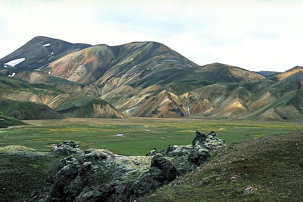
Iceland’s most famous highland destination is Landmannalaugar, an area known for its multi-colored mountains, twisted lava fields, and as the starting point for the Laugavegur Trail (a 4-day trek). This is a great place to visit to undertake some spectacular hikes; the nature reserve is filled with tempting mountains, giant craters, and steaming geothermal valleys.
The focal point for everyone visiting Landmannalaugar is its rhyolite mountains, pictured in just about every article and guidebook ever written about Iceland. Depending on the light conditions, these pyramid-shaped peaks change color from reddish browns to subdued yellows, with colorful streaks of blue, green, and purple throughout the mountains – ash trapped in the stone from previous eruptions.
There’s also a fantastic natural hot spring (Landmannalaugar means ‘The People’s Pools’,), and nearby volcanic craters and lakes.
Getting to Landmannalaugar
Landmannalaugar is accessed via three different F-roads. The easiest approach is from the north, along F26 and then F208. Slightly harder is the approach from the west along F225 thanks to several unpredictable river crossings. Even harder still is approaching along F208 from the south, a route that leads you across several large river crossings.
Accommodation in Landmannalaugar
There are a few accommodations options to consider if you’re visiting Landmannalaugar. There’s a mountain hut that can sleep 78 people, although it’s often booked out months in advance due to the popularity of the Laugavegur Trail.
Right next door is also a campsite, and about 1.5–2 hours away is the Highland Center Hrauneyjar, which makes for a good overnight stay before driving to Landmannalaugar for the day.
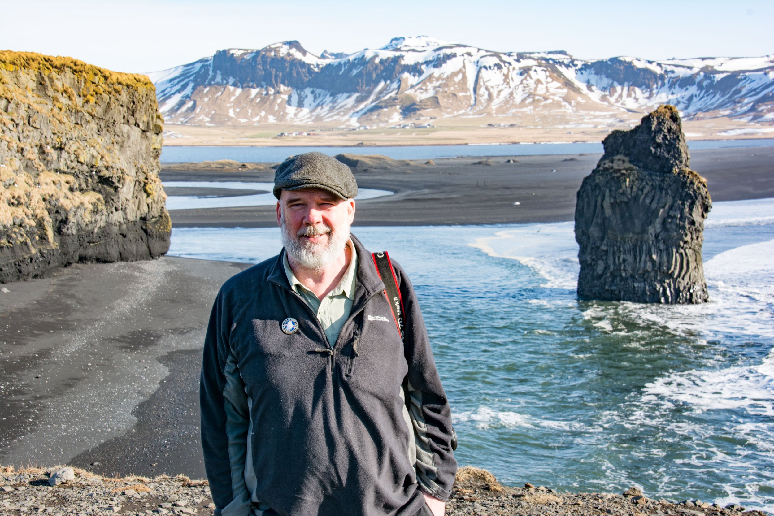
2. Thórsmörk
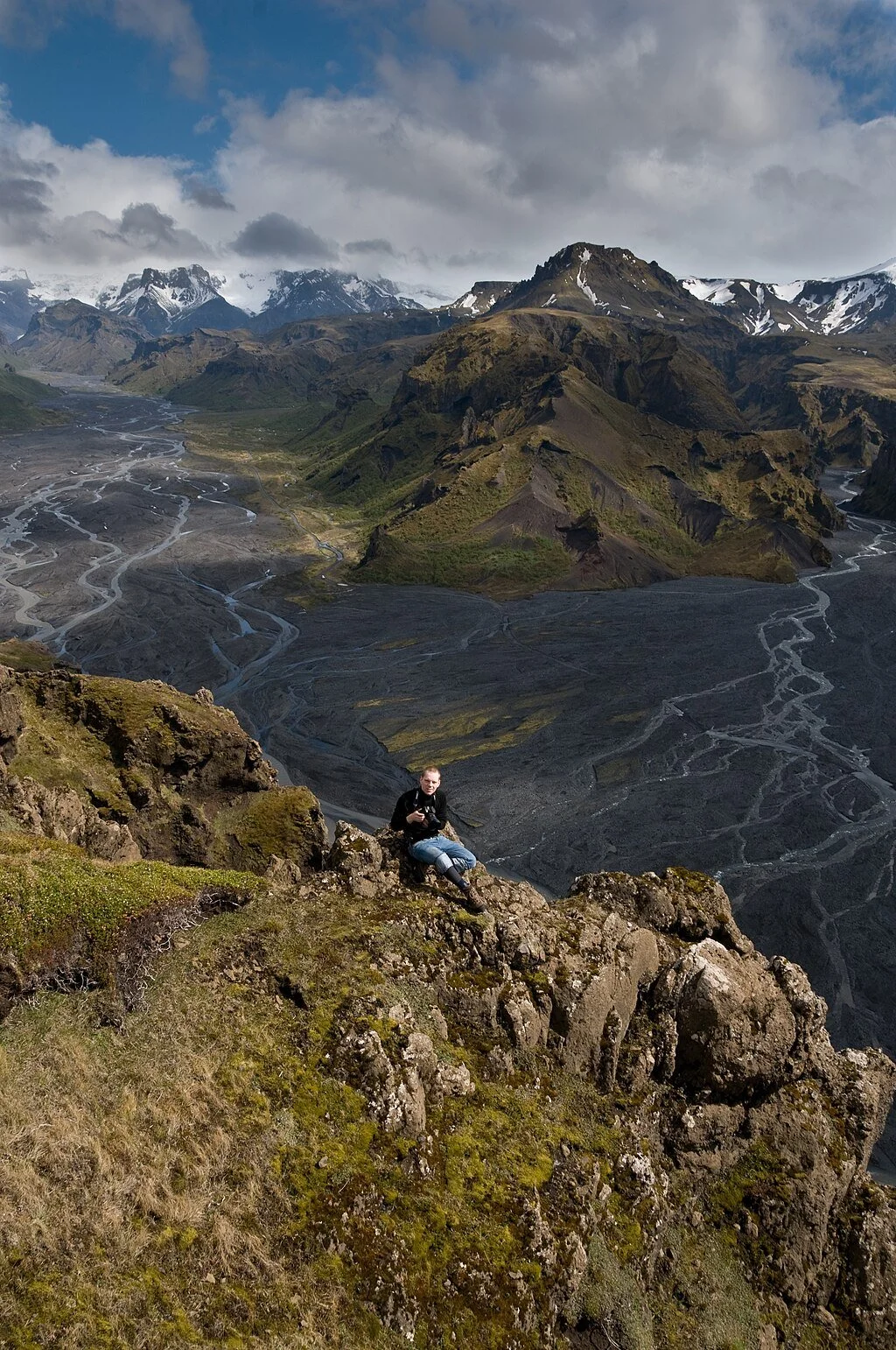
Photo: David Karnå, CC BY 3.0, via Wikimedia Commons. Cropped from original
Nestled between the glaciers Tindfjallajökull and Eyjafjallajökull in southern Iceland, Thórsmörk is a lush valley filled with birch forests, stunning lava rock formations, and glacial rivers that are braided throughout a bed of black sand. This is another place well known for its stunning hiking trails and is also home to a healthy population of Arctic foxes.
Nowhere else in Iceland shows off the moss, basalt, and glaciers in such style than in Thórsmörk. Extended hiking trails take you closer to the ice caps, glittering white in the sky, while other trails delve into secretive canyons, where water rushes down the sides and the striking contrast of green moss and ashen basalt makes you feel as if you’ve stepped into a fairytale.
Thórsmörk is also the ending or beginning point of the Laugavegur Trail, the epic 5-day hiking trail between here and Landmannalaugar. From the reserve, you can also choose to hike over Fimmvörðurháls, the mountain pass connecting Thórsmörk with Skogafoss on the south coast.
Getting to Thórsmörk
Alas, this natural paradise is one of the hardest places to reach in Iceland by yourself. Driving here involves navigating F249, a road with multiple river crossings that can be quite difficult.
But it’s the final crossing that has claimed many a rental car: the Krossá river. This river is often deep and runs fast and should only be attempted in proper conditions and by drivers with a lot of experience crossing rivers.
Accommodation in Thorsmork
Visitors can stay in the three separate mountain huts: Langidalur, Húsadalur, and Básar. There’s also the Volcano Huts, which offer a range of accommodation from basic camping and glamping to dorm accommodation and private mountain huts.
3. Kerlingarfjöll

Kerlingarfjöll, a geothermal wonder in Iceland's central highlands, boasts a staggering blend of steaming hot springs, vibrant rhyolite mountains, and rugged highland terrain. This stunning area is renowned for its surreal landscapes, a quieter and more remote version of Landmannalaugar.
The colorful hills, steaming vents, and boiling hot springs and mud pots are all accessible via wonderful hiking trails, the entire area feeling as if you’ve stepped onto another planet entirely.
Like Landmannalaugar, you might have also seen this place in pictures. Wooden steps have been embedded into the spines of the hills and mountains for hikers, and with steam billowing across the hills from the valleys below, Kerlingarfjöll enjoys a mystical and mysterious atmosphere.
Next to the boiling water at the bottom of valleys you can spy out the bright greens, yellows, and blues of the geothermal power interacting with minerals, and extended hikes up the nearby mountains provide unfettered views into the stark interior of Iceland.
Historically, Kerlingarfjöll was where Icelanders came year-round to learn to ski. Nowadays, summers are warmer, and the snow that used to blanket the mountain peaks even in July and August is no more.
Getting to Kerlingarfjöll
Accessing Kerlingarfjöll involves driving on F35, also known as the Kjölur Route, which runs through the heart of the Icelandic highlands. From Gullfoss waterfall at the top of the Golden Circle area, it takes between 2–3 hours, with spectacular views of glaciers, mountains, and highland desert along the way.
Accommodation in Kerlingarfjöll
The Kerlingarfjöll Mountain Resort offers a variety of accommodation options for overnight stays, including cabins, hotel rooms, and a campsite.
4. Askja

Askja is a striking volcanic caldera located in the Dyngjufjöll Mountains north of the glacier Vatnajökull. This is one of the most remote and extreme Highland destinations, surrounded by desolate desert and violent volcanic landscapes.
This caldera was created in the huge eruption in 1875, when a magma chamber collapsed in on itself. The subsequent depression in the earth then filled with water, becoming the impressive Lake Öskjuvatn, the deepest lake in Iceland.
That eruption also formed the volcanic crater Viti, which sits right beneath the Askja volcano and next to the lake. Viti is also filled with water, except this water is warm and a chalky-turquoise color, allowing people to bathe here.
The hiking trails here all involve admiring these three natural features, and you’ll feel dwarfed by just how large the caldera is. The entire place is still very much an active volcanic zone; the lake continues to sink lower into the earth, and the last eruption occurred in 1961.
The extensive lava fields and unhospitable terrain led NASA to choose this location to train their astronauts for the Apollo program.
Getting to Askja Crater
The journey to Askja involves driving F88 from the north or F905 from the northeast. Both routes require a high clearance 4x4 due to rough roads and river crossings.
F88 has one river crossing that is known to swell to impassable levels after rainfall. There’s also an approach from the west via F910, but this involves the most difficult terrain and river crossings, so it’s mostly left to the experts.
Accommodation near Askja Crater
The Dreki Mountain Hut offers basic lodging facilities for those looking to stay close to the crater. You can also stay at Möðrudalur Farm, holding the distinction of being the most elevated inhabited location in Iceland, which is between 2 and 3 hours to the northeast, closer to the ring road.


5. Snæfell

Photo: Anjali Kiggal, CC BY-SA 4.0, via Wikimedia Commons
Snæfell is the highest freestanding mountain in Iceland, offering unparalleled views of the wild and remote Highland region east of the glacier Vatnajökull. The mountain’s slopes and surrounding landscapes provide excellent hiking opportunities, untouched and pristine wilderness, and a surprising amount of vegetation that attracts a lot of wildlife, including Iceland’s wild reindeer population.
As you venture closer to Vatnajökull, you’ll discover remote valleys leading to giant glacier tongues and geothermal areas, most of them visited by only a handful of people each year.
During the summer, mountain rangers stationed at the hut offer free guided hikes. It only became accessible after the Kárahnjúkar Dam was opened in 2009, so it feels far more untouched than other destinations in the Highlands.
Summiting Snæfell itself is a must-do (if the weather allows), as it provides astounding views of Vatnajökull glacier, and the canyons, rivers, and rocks leading up to this side of the giant ice cap.
Getting to Snæfell
Accessible via F909, Snæfell requires a capable 4x4 due to several river crossings. The route provides a dramatic entrance to the Eastern Highlands and even continues past the mountain all the way to the northern edge of Vatnajökull glacier.
Accommodation near Snæfell
Next to Mount Snæfell is the Snæfellsskáli Mountain Hut, located at the base of the mountain. Staffed by a warden, it’s a cozy shelter and a good spot to stay the night. Camping is also available here.
6. Lakagígar

Photo: Zinneke, CC BY-SA 3.0, via Wikimedia Commons
The Laki Craters, a row of volcanic fissures and craters, are the remnants of a cataclysmic eruption in 1783. This area is a dramatic testament to Iceland’s volcanic power, with craters, lava fields, and moss-covered landscapes. This huge eruption caused widespread famine across Europe, a trigger for the French Revolution.
The crater row of Lakagígar stretches for 29km and is covered in the typical Icelandic moss contrasting with the black sand beneath. It makes for a dramatic sight, and hiking trails from the parking area take it all in.
Longer trails venture alongside the crater row, while shorter venture down into the craters themselves. This area is one of the least visited in the Vatnajökull National Park and is truly an untouched wilderness.
Getting to the Laki Craters
Reaching Laki involves navigating F206 and F207, roads that require a sturdy 4x4 vehicle due to rough terrain and river crossings. The journey offers spectacular views of the volcanic landscape. However, it’s quite difficult, so you need to be experienced drivers/
Accommodation near the craters
Nearby to Lakagígar is the mountain hut and campsite called Blágil & Hrossatungur, offering basic accommodation. For most people, it makes most sense to stay in more comfortable accommodation in the nearby village of Kirkjubæjarklaustur and do a day trip to the craters.
7. Eldgjá & Langisjór
Langisjór. Photo: Ilya Grigorik, CC BY-SA 3.0, via Wikimedia Commons

Eldgjá. Photo: Borvan53, CC BY-SA 3.0, via Wikimedia Commons. Altered from original
Eldgjá and Langisjór are two captivating destinations in the Icelandic highlands to the west of the glacier Vatnajökull, close to the Lakagígar crater row. Both destinations are also very remote and far off the beaten path, offering plenty of serene isolation in some spectacular nature.
Eldgjá is the giant volcanic fissure that was created when the volcano Katla erupted in the 10th century. At its most extreme, it’s 150 meters deep and around 600 meters wide, giving you an idea of just how powerful the eruption was from Iceland’s most famously destructive volcano – the fissure stretches almost the entire way from Mýrdalsjökull glacier to Vatnajökull.
Today, the major highlight of visiting Eldgjá is simply hiking through the canyon, stopping off at the impressive and powerful waterfall Ófærufoss.
Further to the north of Eldgjá is Langisjór. This pristine lake is surrounded by rugged highland terrain, with moss-covered mountains, glacial ice, and black sand. When contrasted with the strikingly clear water of the lake, the landscape really becomes something special.
In both locations, make sure you stick to the marked paths to avoid causing any damage to the environment.
Getting to Eldgjá and Langisjór
Eldgjá is accessed by traveling north from the ring road along F208. Then, after Eldgjá, F208 continues, with F235 eventually branching off to the northeast and leading you to Langisjór on the fringes of Vatnajökull glacier.
Both routes are challenging but take you through what is widely considered as some of the best scenery in the Highlands.
Accommodation Options
Near Eldgjá, travelers can spend the night at the Hólaskjól Highland Center, offering comfortable mountain huts and dorm-style accommodation. You can also choose to camp here. Similarly, at Langisjór, a remote campsite near the lake allows visitors to stay in this tranquil setting but be prepared for minimal facilities.
What to do in the Highlands
Tackle the Kjölur route (F35)
The Kjölur Route, also known as F35, is a highland road that cuts through the heart of Iceland, connecting the south and north. It’s a historic route that the first settlers used to take on their way to and from Thingvellir, where the chieftains would meet to pass laws, trade, and settle feuds. It begins at the southern end near Gullfoss and emerges in the north near the village of Varmahlíð.
There are no river crossings on F35, making it an attractive Highland route for first timers who aren’t comfortable with river crossings. The scenery is desolate, with the vast rocky plateau covered in sand and with glaciers and lakes on either side. There are two major points to stop off at along the way, Kerlingarfjöll and Hveravellir, which we have covered above.

Hveravellir. Photo: Eric Spenle, CC BY 3.0, via Wikimedia Commons
Hike the Laugavegur trail
Hiking is a highly rated activity wherever you are in the Highlands, but the Laugavegur Trail is a stand-out. This popular 4-day trek traverses the volcanic landscapes between Landmannalaugar and Thórsmörk, offering up a staggering amount of spectacular natural scenery along the way.
Accommodation is in various mountain huts along the way, which must be reserved months in advance. You can also get to and from the trailheads via public transport.
Along the trail. Photo: Andreas Tille, CC BY-SA 4.0, via Wikimedia Commons
Admire Iceland’s most extreme volcanic landscapes
Iceland has been created through the interplay of fire and ice, and nowhere else is it more evident than in the Icelandic Highlands. This is a region of extremes, where the lava fields are vast, the glaciers are at their most powerful, and volcanoes brood just beneath the surface.
The Askja volcanic caldera is one of the best places to visit for a clear look at the volcanic power, the huge caldera being formed after the collapse of a magma chamber underground.
The Laki Craters are another great example of the volcanic power of Iceland, the huge crater row left behind after a devastating eruption in the 18th century that sparked a famine across Europe. The Highlands are a region of vivid colors and contrasts, immense geothermal power, and desolate, primordial scenery.

Connect with an Iceland local expert for help perfecting your itinerary, answers to all your travel questions, and fabulous local tips for a better visit!
Drive the challenging Sprengisandur route (F26)
Like the Kjölur Route, Sprengisandur, or F26, is a road that connects north Iceland with the south. It tracks diagonally across the Highland region, from the southwest to the northeast. It’s a long and challenging road, traversing vast deserts of black sand, powerful glacial rivers, and a stark, sub-Arctic wilderness.
At the southern end, Sprengisandur begins at the top of the Thjórsárdalur Valley. After passing the turn off to Landmannalaugar, you’ll drive past giant glacial lakes, through volcanic valleys, and traverse the largest desert in Iceland.
Further north, you’ll pass canyons carved out by glacial floods, occurring after eruptions underneath Vatnajökull. The F-road emerges in North Iceland right next to the waterfall Goðafoss, a popular ring road stop.
You’ll need to stay overnight along the way when doing this driver, and the Nýidalur Hut is roughly halfway, offering basic facilities and a welcome shelter in the middle of the desolate landscape.

Along the route. Photo: Hansueli Krapf, CC BY-SA 3.0, via Wikimedia Commons
Soak in remote hot springs
One of the most relaxing and unique experiences in the Icelandic Highlands is soaking in natural hot springs, the ideal way to recuperate after the rugged hiking trails. The Landmannalaugar region is famous for its geothermal activity, offering a large hot spring where you can unwind right next to the lava field.
Hveravellir and Kerlingarfjöll also have their hot springs, and in East Iceland, a unique hot spring waterfall called Laugarvellir.
Finally, bathing in the volcanic crater of Viti in Askja will be a huge highlight of any highland journey.

.jpeg)
Hike the Fimmvörðuháls Pass into Thórsmörk
This one-way hike connects Thórsmörk in the highlands with Skógafoss on the south coast and is a popular addition to those looking to extend their Laugavegur Trek. Fimmvörðuháls is the name of the mountain between the two glaciers, Eyjafjallajökull and Mýrdalsjökull, and the hike takes anywhere between 6 to 8 hours.
The views of the glaciers and of Thorsmork as you get closer are incredible, and you’ll also have the chance to get up close and personal with the lava fields and craters created in the famous 2010 Eyjafjallajökull eruption that shut down air travel across Europe.
Seek out the Icelandic wildlife
The Icelandic Highlands are home to a variety of unique Arctic wildlife, making it a fascinating destination for nature lovers. In the Eastern Highlands, a population of reindeer roam the valleys and plateaus, brought in for farming by Norway in the 18th century. Despite their best efforts, farming reindeer never caught on, and today the population roam freely through the east.
Birdwatchers will also find plenty to love in the Highlands, with chances to spot all kinds of birdlife in the remote lakes. In Thorsmork, a resident population of Arctic foxes can often be seen darting through the birch forests in search of food.


Connect with an Iceland expert!